
Massive Winter Storm Leaves Dangerous Cold in Its Wake
Get the latest regional and local updates in Edison, Rahway, Woodbridge, after a powerful winter storm blanketed Central Jersey.
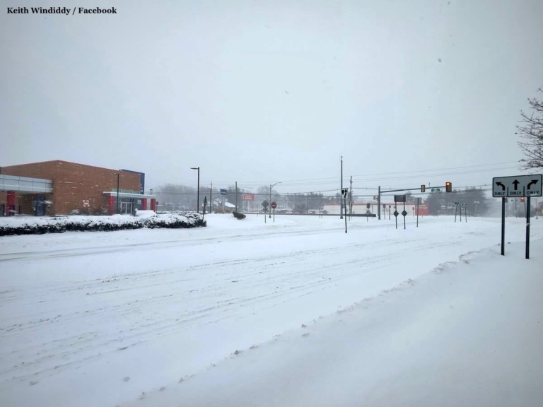
The showy view of Old Post Road along Shoprite Plaza, facing Route 1, In Edison on Sunday, January 25, 2026. (Credit: Keith Windiddy / Facebook)
Chris Howell I January 24, 2026
Residents in Edison, Woodbridge, and Rahway had a final window this Saturday to finalize preparations ahead of heavy snow and dangerous travel across Central Jersey. A state of emergency went into effect Saturday evening. Local officials urged the community to complete errands and move vehicles before conditions rapidly deteriorated overnight and through Monday morning.
***Update: January 26, 4:00 PM***
A water main break in Edison has forced the closure of Route 1 in both directions between the Morris Goodkind Bridge and Plainfield Avenue, authorities said.
The shutdown was confirmed by Edison Deputy Police Chief Robert Dudash. Northbound traffic in New Brunswick is being diverted to Route 18 as crews respond to the incident.
As of this update, no estimated timeline has been provided for when Route 1 will reopen. Efforts to reach additional agencies for details have been hampered by office closures tied to the ongoing effects of the weekend winter storm.
Local officials have not indicated whether the water main break is directly related to freezing conditions, but the closure adds to the region’s storm recovery challenges, particularly for commuters navigating icy conditions and ongoing snow cleanup.
This post will be updated as soon as more information becomes available, including any guidance from transportation or public works officials on repair progress and reopening plans.
DON’T LET AN ALGORITHM DECIDE YOUR NEWS
Independent hyperlocal news that’s fast, fair, and accurate.
***Update: January 26, 10:00 AM***
The winter storm has moved out of Central Jersey, but officials warn that dangerous cold and wind chills are now the primary concern as cleanup efforts continue across the region.
According to the latest National Weather Service briefing, a Cold Weather Advisory is now in effect through Wednesday morning, with daytime temperatures expected to remain in the teens and 20s and overnight lows dropping into the single digits or below zero. Wind chills are forecast to range from 0 to minus 15 degrees, increasing the risk of frostbite and hypothermia, especially during prolonged outdoor activity.
In response, municipalities are opening warming shelters to assist residents without reliable heat. In Rahway, officials announced that the Rec Center is being used as a warming center today. In New Brunswick, officials announced that Lord Sterling School is being used as a warming center today, as students and staff have a snow day.
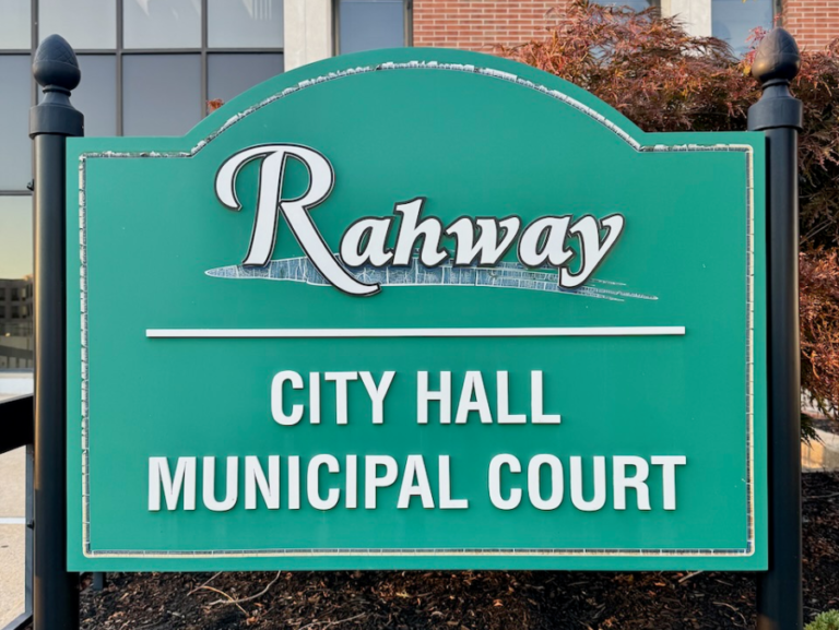
Rahway City Hall is closed on Monday due to the weather conditions. (The Central Jerseyan)
As residents shovel out sidewalks and driveways, public works officials are also urging caution. Municipal advisories, including one issued in Linden, remind residents not to shovel snow back into the street, calling the practice dangerous and counterproductive. Snow pushed into roadways can refreeze, create hazardous driving conditions, and undo plowing efforts as crews continue clearing streets.
Public transportation is beginning a phased return to service, though significant disruptions remain. NJ Transit reports select bus routes resume service starting at 10 AM, and all three light rail lines are operating on weekday schedules with delays. Rail and Access Link service remains suspended as crews inspect infrastructure and clear remaining snow and ice. Officials caution riders to expect delays and to check for updates before traveling.
Forecasters say the cold is expected to linger through much of the week, meaning snow and ice will melt slowly, and hazardous conditions may persist even after roads appear cleared. Residents are urged to limit time outdoors, check on neighbors, and give road crews space to finish their work safely.
***Update: January 25, 8:00 PM***
New data from the National Weather Service show significant accumulations already on the ground, with more to come.
Local snowfall reports from the National Weather Service indicate totals generally trending from 7 to 11+ inches across Central and northern New Jersey as of early Sunday evening, with the heaviest bands still impacting the area. Snowfall rates near 1 to 2 inches per hour were observed during peak periods, especially across inland areas of the Tri-State region.

Edison EMS on standby during Sunday’s winter storm. (Source: Edison EMS / Facebook)
The forecast still calls for snow, sleet, and a wintry mix through tonight, followed by tapering precipitation late. Ice accumulation remains a concern, particularly where sleet and freezing rain mix with the snow, and gusty northeast winds will continue to reduce visibility and create blowing snow. Temperatures are expected to fall into the upper teens and single digits overnight, with dangerous wind chills persisting into Monday and beyond.
In response to deteriorating conditions, schools across the region are closed on Monday, and many businesses are also shuttered as crews continue snow removal and public safety operations.
Officials are urging residents to stay off roads wherever possible to allow plows and emergency vehicles to work safely and efficiently as the storm winds down.
***Update: January 25, 2:30 PM***
Conditions continue to deteriorate across Central Jersey as snowfall accumulates and local impacts expand.
Rahway Public Schools announced a snow day for Monday, and the city’s Department of Public Works has canceled garbage collection for the day, citing unsafe conditions for crews and equipment.
Public transportation has also been halted. NJ Transit has suspended all bus, rail, light rail, and Access Link service, with operations expected to remain paused until conditions allow for a safe, gradual restart. Officials have warned residents not to plan travel and to monitor for updates on service resumption.
Snow totals are also beginning to confirm earlier forecasts. In nearby Trenton, more than 7 inches of snow has already fallen, according to the National Weather Service, with additional accumulation expected as the storm continues.

Gov. Mikie Sherrill visited the Statewide Traffic Management Center in Woodbridge on Sunday, January 25, 2026. (Source: New Jersey Governor’s Office / Facebook)
Gov. Mikie Sherrill said Sunday that she stopped by the Statewide Traffic Management Center in Woodbridge Township to monitor conditions and coordinate the state’s response closely. In a social media post, the governor again urged residents to stay off the roads, remain home if possible, and prioritize safety as conditions worsen statewide.
Forecasters continue to warn that the combination of heavy snow, ice, wind, and bitter cold will keep travel dangerous and cleanup slow into Monday, with additional school and service announcements expected across the region.
***Update: January 25, 9:00 AM***
Forecasters now expect widespread snow and sleet totals of roughly 4 to 8 inches in southern areas and 12 to 16 inches farther north, with 7 to 11 inches likely along and near the I-95 corridor, including much of Central Jersey. Snowfall rates of 1 to 2 inches per hour are possible at times on Sunday.
Of growing concern is the ice threat, particularly Sunday afternoon into Sunday night, as snow and sleet mix with or change to freezing rain. Ice accumulations of one-tenth to one-quarter inch are possible, increasing the risk of dangerous travel, downed tree limbs, and isolated power outages, especially when combined with gusty northeast winds.
The storm will be followed by a prolonged stretch of dangerous cold, with daytime highs expected in the teens and 20s and overnight temperatures dropping into the single digits or below zero through much of the coming week. Wind chills could dip below minus 10 degrees, raising concerns about frostbite, hypothermia, and strain on infrastructure.
In response to the worsening forecast, Union County schools have already announced a delayed opening for Monday, signaling that storm impacts are expected to linger into the start of the workweek. Additional school districts across Central Jersey are expected to announce decisions as conditions develop.
Forecasters stress that even where snowfall totals vary, the combination of snow, ice, wind, and cold will make travel very difficult or impossible at times and could significantly slow cleanup efforts into Monday and beyond.
***Update: 7:15 PM***
NJ Transit will suspend all bus, light rail, and Access Link service beginning at 4 a.m. Sunday, with rail service ending at 2 p.m. on Sunday, as a major winter storm intensifies across New Jersey. Service will remain suspended through Sunday night and into Monday, with updates on resumption expected later Sunday as conditions are assessed.
Gov. Mikie Sherrill reiterated during a Saturday afternoon briefing that residents should avoid travel beginning tonight and throughout Sunday, warning that dangerous road conditions will worsen as heavy snow, sleet, and ice move through the region. The statewide state of emergency goes into effect at 5 p.m. Saturday, and commercial vehicle travel restrictions begin at midnight, with exemptions for vehicles carrying food, fuel, medical supplies, and other essential services.
State transportation officials also announced temporary speed restrictions of 35 mph on the New Jersey Turnpike, Garden State Parkway, and all state and interstate highways beginning at midnight, urging drivers to stay off the roads and not attempt to pass snow plows.
The latest briefing from the National Weather Service indicates snowfall totals have been slightly reduced, but confidence remains high that major impacts are still expected, particularly due to a mix of snow, sleet, and freezing rain. Forecasters warn that this combination will make travel dangerous or impossible at times, with widespread disruptions likely across Central Jersey and along the I-95 corridor.
Officials continue to stress that Saturday is the final window to prepare, urging residents to finish errands, charge devices, check on neighbors, and plan to remain indoors as conditions deteriorate.
***Updated: 9:53 AM***
How to prepare today
Local and state officials are asking residents to use Saturday to prepare, and to do so with patience.
Long lines are expected at grocery stores, pharmacies, and hardware stores, along with heavier-than-usual traffic on local roads as residents make last-minute trips. Officials recommend allowing extra time, avoiding late-day errands if possible, and remaining patient with workers, drivers, and neighbors as crowds increase.
Residents are encouraged to complete grocery and prescription runs, fuel vehicles, charge phones and backup batteries, and prepare flashlights and emergency supplies. Outdoor items such as trash cans should be secured, and neighbors — especially seniors and others who may need assistance — should be checked on before conditions deteriorate.
Once snow begins, officials are urging people to avoid travel unless necessary.
Forecast snapshot
Snowfall totals are expected to vary across Central Jersey, according to the National Weather Service, with Interstate 78 serving as a rough dividing line.
Areas generally south of I-78 are forecast to receive 8 to 12 inches of snow, while areas north of I-195 could see 12 to 18 inches. The heaviest snowfall is expected Sunday into early Monday, with cold temperatures increasing the risk of refreeze and lingering hazardous conditions.
Forecasts can still change, and The Central Jerseyan will be posting updates as the storm approaches.

Source: The Central Jerseyan & National Weather Service (Generated with Gemini)

Local Service Updates & Closures
Edison Township
- Garbage & Recycling: Monday pickup is canceled and will resume on Tuesday.
- Warming Center: Opening Saturday evening at the Senior Center on Woodbridge Avenue.
- Utilities: Water and sewer crews are currently on standby for storm-related issues.
Woodbridge Township
- Monday Closures: All township libraries, community centers, and senior/youth centers are closed.
- Trash Collection: Garbage and recycling pickup is delayed by one day.
Schools: Decisions regarding closures or remote learning will be announced as conditions develop.
Rahway
- Parking: Officials are strictly enforcing all snow emergency routes.
- Plowing: DPW operations will remain continuous throughout the storm.
Parking, Plowing, and Neighborhood Safety
Snow Emergency Routes
- Remove vehicles from designated routes in Edison, Rahway, and Woodbridge.
- Violators may be ticketed or towed.
Restrictions may remain after the storm until roads are cleared.
Plowing & Driveways
- Main roads are prioritized over residential streets.
- Neighborhoods may be plowed multiple times.
Driveway entrances may be repeatedly blocked.
Safety Reminders
- Large snowbanks can block sightlines.
- Neighborhoods may be plowed multiple times.
- Driveway entrances may be repeatedly blocked.
- Large snowbanks can block sightlines.
- Plow drivers have limited visibility.
- Keep children away from roadways and equipment.
- Pedestrians should use extra caution.

Gov. Mikie Sherrill delivers a winter weather briefing alongside state transportation, emergency management, and utility officials. (New Jersey Governor’s Office / Facebook)
State response and travel impacts
Speaking Friday during her first major press conference since taking office, Gov. Mikie Sherrill said the state is preparing for what she described as a rare, high-impact winter storm.
“This is not an average winter storm,” Sherrill said. “This is a storm the likes of which we haven’t seen in probably about a decade.”
Sherrill urged residents to avoid travel beginning Saturday night and throughout Sunday, warning that road conditions will be dangerous and that emergency crews need clear access to highways and local streets. A commercial vehicle travel restriction will be in effect on interstate highways to prevent crashes that could block plowing operations and delay first responders.
State transportation officials said crews are pre-treating highways and interstates and will deploy thousands of pieces of equipment statewide, including along the New Jersey Turnpike and Garden State Parkway. Drivers were warned not to pass snow plows or attempt to weave between them.
NJ Transit officials said potential service changes for rail and bus lines will be announced based on updated forecasts, adding that the Monday morning commute could be significantly impacted in some areas.